Featured Index
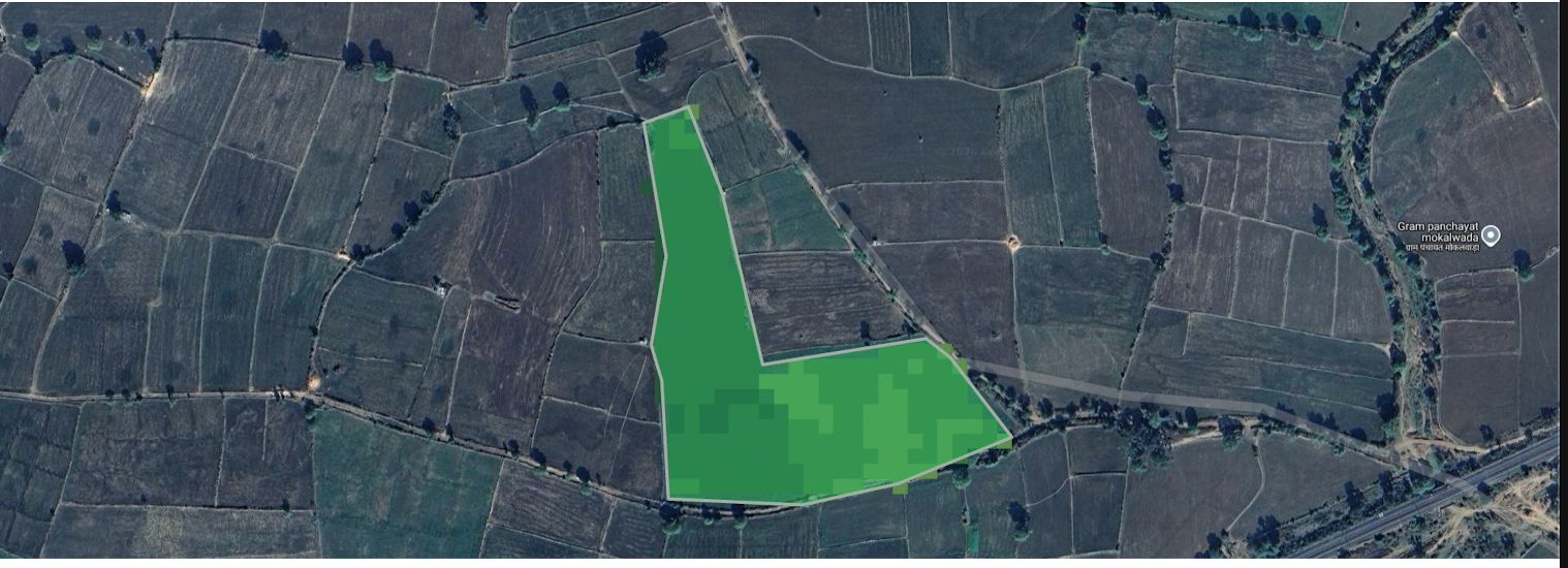
NDVI
Normalized Difference Vegetation Index
The industry standard vegetation index used for crop health monitoring, biomass analysis, and early detection of crop stress.
Agricultural Analytics

Monitor crop health, soil moisture, vegetation growth, weather conditions, and field performance using satellite imagery, precision agriculture technology, and advanced farm intelligence solutions.
Fasalam helps farmers, agribusinesses, and agricultural professionals make data-driven decisions through satellite crop monitoring, weather forecasting, vegetation analysis, soil moisture tracking, crop health monitoring, and precision agriculture insights. Improve productivity, optimize irrigation, reduce farming risks, and maximize crop yield with real-time agricultural intelligence.
Satellite farming platform offering crop health monitoring, precision agriculture, satellite crop monitoring, weather forecasting, vegetation analysis, soil moisture tracking, smart irrigation support, agricultural intelligence, and farm management solutions for farmers and agribusinesses.
Satellite vegetation indices help farmers monitor crop health, vegetation growth, soil moisture, irrigation efficiency, and field performance. Advanced remote sensing technologies provide actionable insights for precision agriculture, helping farmers make data-driven decisions and improve productivity.
Access historical and real-time agricultural analytics using advanced satellite imagery from 2018 to today.
Normalized Difference Vegetation Index
The industry standard vegetation index used for crop health monitoring, biomass analysis, and early detection of crop stress.
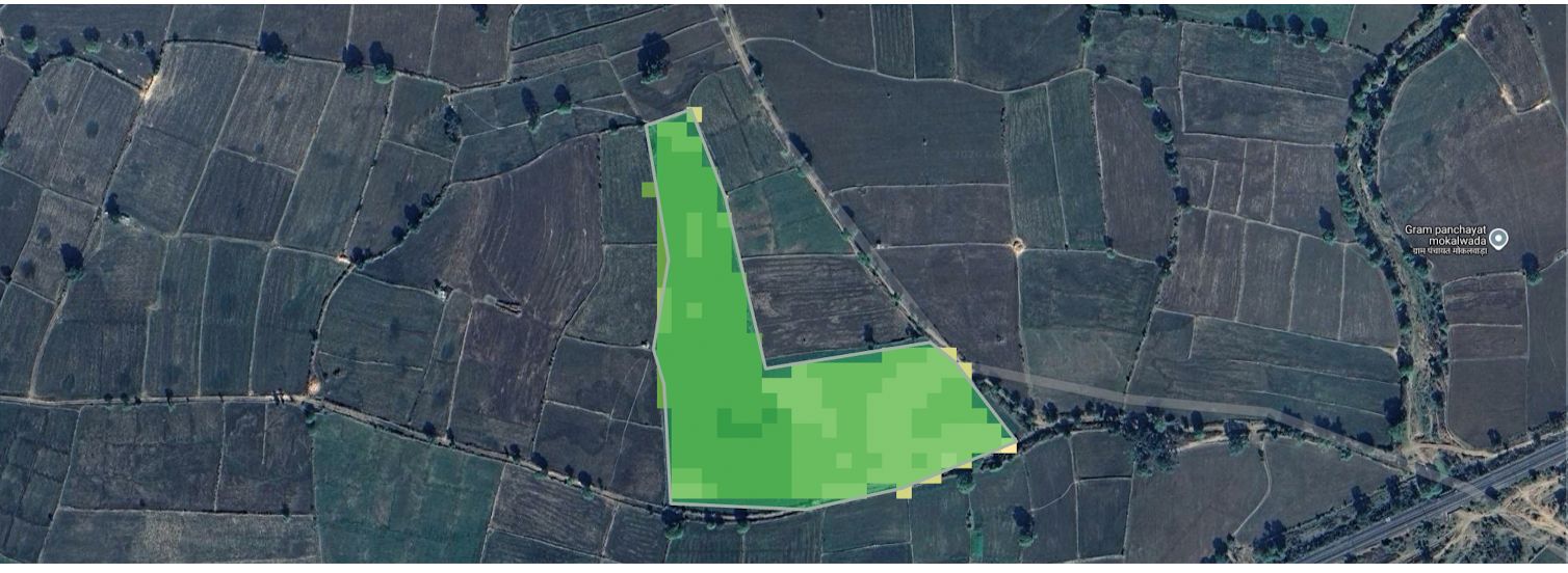
Enhanced Vegetation Index
Provides improved sensitivity in dense vegetation areas while reducing atmospheric interference for more accurate crop analysis.
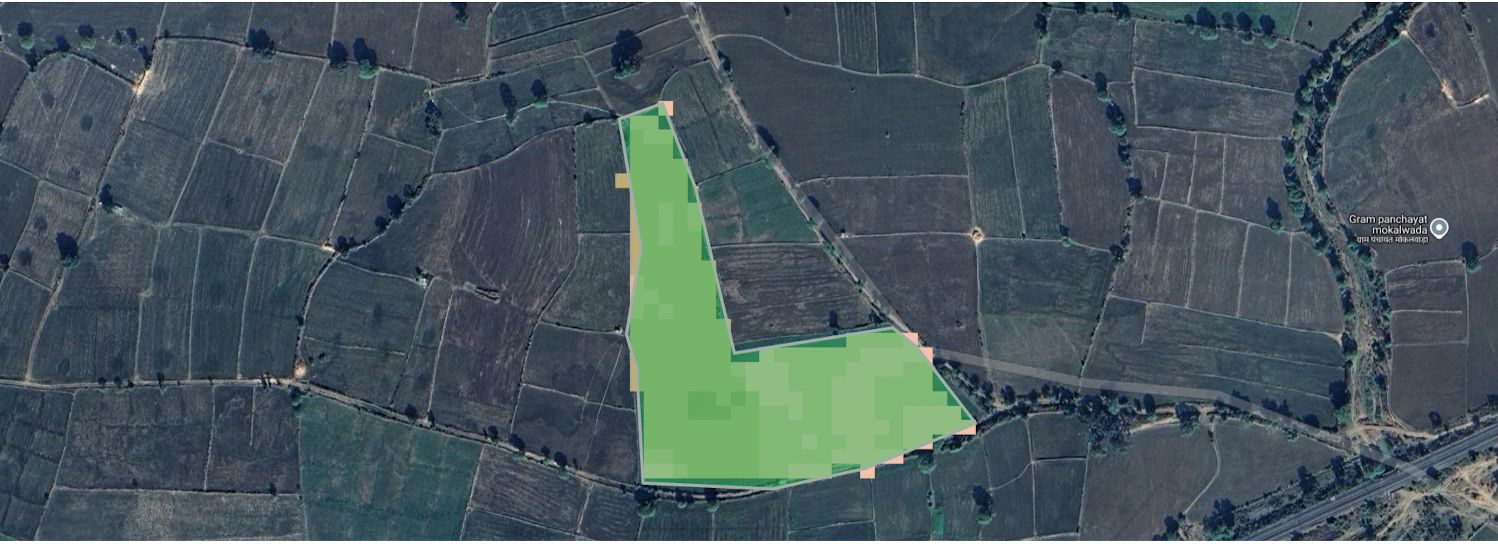
Soil Adjusted Vegetation Index
Minimizes the influence of soil brightness, making it ideal for monitoring crops in areas with sparse vegetation cover.
NDVI, EVI, SAVI, NDWI, and other vegetation indices enable farmers to monitor crop health, detect stress early, analyze vegetation growth, and improve irrigation planning. By combining satellite imagery with agricultural analytics, farmers gain valuable insights that support better decision-making and sustainable farming practices.
These remote sensing tools are widely used in precision agriculture for yield optimization, crop monitoring, field management, soil moisture analysis, and farm performance tracking across large agricultural areas.
Access advanced agricultural intelligence through satellite imagery, weather forecasting, soil moisture tracking, climate monitoring, and historical data analysis. Our platform helps farmers, agribusinesses, and agricultural consultants make informed decisions using real-time geospatial insights.
Monitor crop health, vegetation indices, field conditions, and land-use changes using high-resolution Sentinel and Landsat satellite imagery.
Imagery Cadence
Ultra-frequent refresh cycle for real-time crop monitoring and field evolution tracking.
Historical Archive
Historical satellite imagery for long-term agricultural performance analysis.
Multi-Source Fusion
Combined satellite datasets deliver accurate agricultural intelligence.
Soil Insights
Track soil moisture and environmental conditions across multiple depths.
Access weather forecasts, rainfall predictions, temperature trends, wind analysis, and historical climate data to optimize agricultural operations.
Global Coordinates
Access weather information for any location worldwide.
Hyper-Local Forecast
Accurate short and medium-range forecasts with granular updates.
Atmospheric Metrics
Humidity, rainfall, wind speed, temperature and pressure monitoring.
Climate Archive
Historical weather records for agricultural planning and research.
Combining satellite imagery, weather forecasting, soil moisture monitoring, and historical climate analysis enables better agricultural decision-making. Farmers can identify crop stress, monitor vegetation health, improve irrigation planning, reduce risks from adverse weather, and increase productivity through data-driven farming practices.
Experience the depth of orbital precision. Preview our comprehensive field analysis report to see how raw data transforms into agricultural wisdom.
Our proprietary reporting system provides centimeter-level mapping, multispectral time-series analysis, and diagnostic health indicators for any geographical area.
File Format
PDF v1.7
Data Source
Sentinel-2
File Size
1 MB
Scale
1:2000
Join thousands of growers leveraging Fasalam's satellite monitoring to optimize every acre.
Farmers
App Rating
Support